Tayrona National Park, Colombia

An original watercolor print from The Painted Passport archive — designed to bring the light, color, and atmosphere of your favorite destinations into your home.
Original Series / Visual Study
Regional Dossier

TAYRONA NATIONAL PARK, COLOMBIA | "Where the Jungle Meets the Caribbean"

Tayrona National Park is the most biodiverse coastal landscape in Colombia and one of the most extraordinary convergences of ecosystem and topography in the Americas, a 150 square kilometer protected area on the Caribbean coast of the Sierra Nevada de Santa Marta where the world's highest coastal mountain range descends directly into the sea, creating a landscape of palm-fringed beaches, coral reefs, cloud forest, and the ancient Tairona city of Pueblito accessible only on foot through the jungle above the shore. The Sierra Nevada de Santa Marta is simultaneously the highest coastal mountain range on earth and the sacred territory of the Kogi, Wiwa, and Arhuaco indigenous peoples who have maintained continuous cultural occupation since the decline of the Tairona civilization in the 16th century.

The colors are tropical and saturated: the brilliant turquoise of the Caribbean where it meets the white sand beaches, the deep green of the Sierra Nevada cloud forest above, the terracotta of the Tairona archaeological sites visible through the vegetation, and the specific deep gold of the afternoon light when it falls across the palm-lined coves of Cabo San Juan at the golden hour.

Add to the collection for /

$18.00

Finding the Stillness

It's hard to put the "vibe" of a place into words, so we put together a few images that we think show the quiet side of Tayrona National Park, Colombia. These are just some of the textures and small moments that felt special to us while we were exploring.

Tayrona National Park, Colombia visual study 01
Tayrona National Park, Colombia / No. 01 via Levi Ari Pronk
The deep green of the jungle meeting the turquoise Caribbean creates a perfect, natural sanctuary for the soul to simply be. It is a place where the rhythm of the waves and the warmth of the sun-soaked boulders remind you to breathe deeply and find your own inner stillness.
Tayrona National Park, Colombia visual study 02
Tayrona National Park, Colombia / No. 02 via Berend Leupen
The dappled sunlight filtering through the canopy highlights a fleeting, curious connection between two very different worlds. It’s a soulful reminder that even in the heart of the wild, there is a shared spark of intelligence and life watching us back from the branches.
Tayrona National Park, Colombia visual study 03
Tayrona National Park, Colombia / No. 03 via Shubham Singh
The iconic Cabo San Juan hut stands as a quiet sentinel between the lush mountains and the vast, shimmering Caribbean. It is a place where the wild energy of the crashing waves meets the stillness of the shore, inviting you to leave the noise of the world behind and simply listen to the sea.

Where to wander

Archival Note: A curated field study of Tayrona National Park, Colombia, prioritizing cultural relevance and archival merit. These locations have been meticulously researched and vetted to ensure they represent the most authentic atmosphere for your own expedition.

Local Cuisine Spotlight
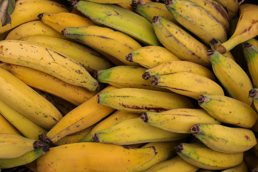
The vibrant gold and green of these market bananas capture the simple, honest abundance of the earth. In their imperfect, sun-ripened skins, there is a beautiful reminder that nature provides everything we need to be nourished and sustained.
Credits: FUKA JAZ
Local cuisine study in Tayrona National Park, Colombia

☕︎ Local Flavor

Santa Marta Street Food Tour: 7 Tastings with a Local Guide

Rating: 4.8★ | Price: $$ | Coordinates: 11.2418° N, 74.2115° W

Navigate the sensory tapestry of the Historic Center to unearth the culinary foundation of the Colombian Caribbean. Savor the textural contrast of cayeye—mashed green bananas enriched with local suero—and the crisp, golden geometry of arepa de huevo prepared over an open flame. This journey serves as a living archive, preserving the lineage of Sephardic, African, and Indigenous flavors that anchor Santa Marta’s identity as the continent’s oldest surviving colonial city.

View Entry Details

Coffee & Cacao Origin Tour in the Sierra Nevada foothills

Rating: 4.7★ | Price: $$ | Coordinates: 11.1444° N, 74.1189° W

Ascend the emerald slopes of the Sierra Nevada to witness the transformation of the Theobroma cacao fruit into sacred artisanal bars. Engage with the fermentation process in cedar boxes, where the beans develop complex notes of stone fruit and earth under the watchful eyes of multi-generational farmers. This site represents a vital piece of the cultural puzzle, preserving the botanical lineage of the world’s highest coastal mountain range.

View Entry Details

Taironaka Indigenous Meeting & Gastronomy

Rating: 4.8★ | Price: $$$ | Coordinates: 11.2461° N, 73.7011° W

Explore the banks of the Don Diego River to partake in a ritualized meal within a traditional Kogui bohío. Analyze the architectural symmetry of the thatched-roof dwellings while consuming ancestral staples like boiled tubers and infusion of coca leaf. The experience acts as a bridge to the past, preserving the spiritual and nutritional lineage of the Tayrona descendants who remain the self-appointed "Elder Brothers" of the earth.

View Entry Details

Santa Marta: Guided Walking Food Experience

Rating: 4.8★ | Price: $$ | Coordinates: 11.2418° N, 74.2115° W

Navigate the sensory tapestry of the Historic Center to unearth the culinary foundation of the Colombian Caribbean. Savor the textural contrast of cayeye—mashed green bananas enriched with local suero—and the crisp, golden geometry of arepa de huevo prepared over an open flame. This journey serves as a living archive, preserving the lineage of Sephardic, African, and Indigenous flavors that anchor Santa Marta’s identity as the continent’s oldest surviving colonial city.

View Entry Details

🛌︎ Boutique Stays

Hotel Boutique Don Pepe

Rating: 4.6★ | Price: $$$$ | Coordinates: 11.2452° N, 74.2128° W

Recline within a meticulously restored colonial manor where 18th-century masonry meets the refined aesthetics of a private villa. The structure features high-beamed ceilings and a central courtyard that channels the Caribbean breeze through original limestone arches. More than a hotel, Don Pepe serves as an architectural anchor for the city, documenting the transition from Spanish colonial outpost to a hub of sophisticated Republican-era luxury.

View Entry Details

Placita Vieja Hotel Boutique Spa

Rating: 4.9★ | Price: $$$$ | Coordinates: 11.2425° N, 74.2117° W

Discover an oasis of Zen-like calm situated directly on the historic Parque de los Novios, housed within a protected heritage building. Each suite showcases a fusion of hydraulic tile floors and contemporary glasswork, centered around a rooftop pool that offers a panoramic study of the city's red-tiled skyline. This property stands as a physical manuscript of urban revitalization, honoring the historical facade while breathing new life into the city's social heart.

View Entry Details

Finca Barlovento Maloka (Tayrona Entrance)

Rating: 4.7★ | Price: $$$ | Coordinates: 11.2936° N, 73.9038° W

Perched precariously between the mouth of the Piedras River and the thundering Atlantic, this wooden sanctuary utilizes traditional Tayrona construction methods. The architecture favors open-air ventilation and sustainable tropical hardwoods, allowing the roar of the ocean to dictate the internal rhythm of the stay. It is a vital architectural experiment, documenting a harmonious lineage between human habitation and the volatile boundary of the Colombian jungle.

View Entry Details

Casa Isabella, a Kali Hotel

Rating: 4.8★ | Price: $$$ | Coordinates: 11.2447° N, 74.2135° W

Inhabit a space where whitewashed walls and turquoise accents mirror the maritime heritage of the nearby Santa Marta Marina. The boutique interior prioritizes artisanal craftsmanship, featuring hand-woven textiles and local ceramics that elevate the daily ritual of rest. This site functions as an anchor for the city's identity, preserving the sophisticated, understated elegance that defined the historic Caribbean port.

View Entry Details

📍︎ Field Study

The Lost City (Ciudad Perdida) 4-Day Trek

Rating: 4.9★ | Price: $$$ | Coordinates: 11.0372° N, 73.9250° W

Ascend 1,200 ancient stone steps to unearth a sprawling archaeological complex that predates Machu Picchu by nearly 650 years. Study the sophisticated circular terraces and complex drainage systems carved from granite by the Tayrona civilization amidst a dense cloud forest. This trek is the ultimate archival journey, preserving the physical lineage of a civilization that mastered the verticality of the Sierra Nevada.

View Entry Details

Quinta de San Pedro Alejandrino Architectural Study

Rating: 4.7★ | Price: $ | Coordinates: 11.2269° N, 74.1878° W

Navigate the sprawling gardens and neoclassical memorials of the 17th-century hacienda where Simón Bolívar spent his final days. Examine the transition from functional sugar mill architecture to the somber, grandiosity of the Altar de la Patria, built to honor the "Libertador." The site remains a vital historical manuscript, documenting the end of the colonial era and the birth of a sovereign South American identity.

View Entry Details

Tayrona National Park: Cabo San Juan Architectural Hike

Rating: 4.8★ | Price: $$ | Coordinates: 11.3183° N, 73.9221° W

Traverse a labyrinth of massive basalt boulders and tropical rainforest to reach the iconic thatched hut perched atop a sea-swept promontory. The trail reveals the strategic layout of ancient indigenous pathways, designed to facilitate trade between the mountain peaks and the coral-rich Caribbean. This excursion preserves the memory of the landscape's original inhabitants, acting as an anchor for understanding the ecological sanctity of the Tayrona region.

View Entry Details

Santa Marta Historic Center & Gold Museum Walking Tour

Rating: 4.6★ | Price: $$ | Coordinates: 11.2441° N, 74.2120° W

Explore the vaulted chambers of the Customs House, the oldest building in the city, which now houses a formidable collection of pre-Columbian gold and pottery. Analyze the intricate "lost wax" casting techniques used by Tayrona goldsmiths to create zoomorphic figures of jaguars and bats. This tour functions as an essential archive, preserving the artistic and metallurgical lineage of a culture that viewed gold not as currency, but as a spiritual conduit.

View Entry Details

Typography

Archival Note: A formal technical study of Tayrona National Park, Colombia, archiving the coordinates, elevation, and environmental data that define the region. This data serves as a vital record for our ongoing global field study, providing the technical foundation behind every atmospheric detail captured in our visual work.

Botanical and pigment specimen study for Tayrona National Park, Colombia Colors of Tayrona National Park, Colombia
Coordinates
11.3142° N, 73.9678° W — Northern Colombia, Sierra Nevada de Santa Marta coast
Historical Epoch
Tayrona indigenous civilization from around 200 CE. Spanish colonial contact from the 16th century. National Park gazetted in 1964. UNESCO Biosphere Reserve designation in 1979.
Elevation
0–900 m / 0–2,953 ft, Caribbean coast rising to the world's highest coastal mountain range
Atmosphere
Tropical Monsoon (Am). Dry season December through March, wet season April through November, hot and humid year-round at sea level with cooling trade winds.
Observation Hour
17:30. The sunset silhouette of the Sierra Nevada de Santa Marta behind the palm-lined beach, the Caribbean turning gold as the humidity softens the light into a warm tropical haze.
Primary Pigment
Tayrona Turquoise (#30D5C8) and Deep Jungle Moss (#344E41)
Best Time to Visit
December through April, the dry season keeps the jungle trails accessible, the sea is calm for snorkeling, and the ancient Tayrona villages are reachable
Avoid Visiting
October through November, the park officially closes for environmental rest, access is restricted, and the trails are flooded by the heaviest rains

Behind The Scenes

Nathan

Note from the Founder

Hey, did you know this fun fact about Tayrona National Park, Colombia? Tayrona’s neon "Blueberry Crabs" (officially Halloween Moon Crabs) are famous for scuttling across the jungle floor to swipe snacks or shiny objects? These bright orange and deep blue characters make the forest floor look like it’s literally dancing in neon as you walk by!
Thank you for exploring the Tayrona National Park, Colombia series with us. We hope these notes have inspired you to add this incredible destination to your own passport—we are so glad you're here. — Nathan

Some of our Favorites