The Moab Collection

Turret Arch Red Rocks, Moab canvas
No. 1

Turret Arch Red Rocks

Desert Stillness Anchors Any Room

From$65.00· 5 sizes

More from United StatesMore of Moab is on its way — until then, explore its neighbours.

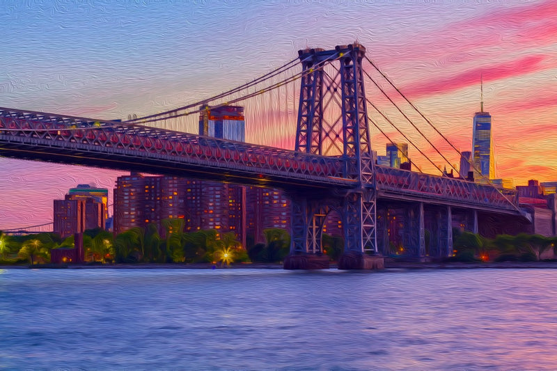
Williamsburg Bridge at Sunset, Williamsburg canvas
Williamsburg

Williamsburg Bridge at Sunset

Brooklyn Dusk Warmth Every Morning

From$65.00

Virgin River Canyon Narrows, Zion National Park canvas
Zion National Park

Virgin River Canyon Narrows

Daily Calm From Zion's Depths

From$65.00

San Felipe de Neri Church, Albuquerque Old Town canvas
Albuquerque Old Town

San Felipe de Neri Church

Old Town Dusk Calm Every Day

From$65.00

Maroon Bells Lake Reflection, Aspen canvas
Aspen

Maroon Bells Lake Reflection

Colorado Alpine Serenity Every Morning

From$65.00

Texas State Capitol Building, Austin canvas
Austin

Texas State Capitol Building

Brings Austin's Golden Hour Home

From$65.00

Santa Elena Canyon Rio Grande, Big Bend National Park canvas
Big Bend National Park

Santa Elena Canyon Rio Grande

Big Bend Solitude in Every Glance

From$65.00

Explore all of United States →

Always adding new places

Missing your favorite spot in Moab, Utah?

This collection grows every week. Tell me the place, the view, or the corner you'd want on your wall, and I'll add it to the list.

I read every one, and I'll only email you about your request.

In Real Homes

On real walls

Every canvas is printed to order and hung by people like you. Here’s how they look at home.

Keep Exploring

Your Next Stop in United States

The Spirit of the Land

Archival Note: Documented personally during our time in Moab, Utah. While we leverage a global network of contributors to provide these high-fidelity visual artifacts, each selection is curated to reflect the specific, quiet frequencies we experienced on the ground. These textures serve as a formal study of the unhurried light and environmental character that defined our journey.

Moab, Utah study No. 01
Moab, Utah / 01 VIA / Colon Freld
From the rim of Dead Horse Point, the Colorado River carves a horseshoe bend far below, its dark water threading quietly through ancient red sandstone. The last light of day settles across the canyon in layers of amber and rose, turning the rock faces warm and alive. It is the kind of stillness that makes a person feel both very small and completely present.
Moab, Utah study No. 02
Moab, Utah / 02 VIA / Elizabeth Iris
A visitor standing beneath Delicate Arch at this moment would feel the charged tension of two weather systems colliding overhead, one side bruised with storm clouds, the other dissolving into rose-pink light. The warm sandstone glows with its own inner heat as the last light catches the canyon walls stretching endlessly into the distance. It is the kind of twilight that makes the landscape feel ancient and alive at once, humbling in its scale and quiet drama.
Moab, Utah study No. 03
Moab, Utah / 03 VIA / Aaron Kittredge
The warm amber light of golden hour saturates the sandstone formations, making Balanced Rock appear almost luminous against the cobalt sky. Most visitors focus on the iconic boulder perched impossibly atop its eroded pedestal, yet few notice the distant La Sal Mountains quietly anchoring the horizon in soft purple haze. The gnarled juniper shrubs in the foreground cast long shadows across the red earth, adding a layer of texture that grounds the scene's otherworldly grandeur.
The Story Behind the Art

The Real Moab

More than a shop, each page is an immersive guide to the real Moab: local tips and tricks, the language you'll hear, where to eat, stay, and explore, the lay of the land, and a fun fact to carry home — every canvas mapped to the very spot it was captured.

Moab, Utah, United States | 'Where the Colorado Carved Its Cathedral'

Moab sits at the confluence of ancient geology and modern adventure, cradled between the rust-colored fins of Arches National Park and the vast mesa country of Canyonlands. The light here is like nowhere else on earth: at golden hour the sandstone walls ignite in shades of copper, ochre, and deep vermillion, casting shadows so long and dramatic they feel almost theatrical. This small desert town has roots in uranium mining and cattle ranching, but it has evolved into one of the American West's most iconic basecamp cities, drawing hikers, climbers, river runners, and artists who keep returning because the landscape simply refuses to be ordinary. The Colorado River threads quietly through the canyon floor below, a silver ribbon beneath towering red walls that have taken 300 million years to become this breathtaking.

A watercolor palette for Moab begins with warm Entrada sandstone reds and shifts through sun-bleached canyon tan and dusty sage green, the colors of desert shrubs clinging to dry washes. Deep Canyonlands violet appears in the shadowed alcoves of mesa cliffs, and a clear cerulean blue crowns every composition like a high desert benediction. Where river meets rock, soft turquoise and pale algae green add a quiet coolness to an otherwise fiery, sun-drenched scene.

We hope you love getting lost in Moab through the art above β€” and that one of these canvases finds a home on your wall. Happy travels, from all of us at The Painted Passport.

Where to wander

Archival Note: A curated field study of Moab, Utah, prioritizing cultural relevance and archival merit. These locations have been meticulously researched and vetted to ensure they represent the most authentic atmosphere for your own expedition.

Local Cuisine Spotlight
This Moab-worthy green chile cheeseburger stacks fire-roasted Hatch peppers and rivers of melted white cheese atop a thick, seasoned beef patty nestled in a toasted brioche bun. Herb-dusted fries and the canyon backdrop make every bite feel like the American Southwest on a plate.
Credits: THE PAINTED PASSPORT
Local cuisine study in Moab, Utah

β˜•οΈŽ Local Flavor

Desert Bistro

Rating: 5* | Price: $$$ | Coordinates: 38.5729, -109.5511

Housed in a charming historic home shaded by mature cottonwood trees, Desert Bistro serves refined Southwestern cuisine that feels both elegant and deeply soulful. Chef-crafted dishes feature locally sourced ingredients woven into creative plates like elk tenderloin and piΓ±on-crusted salmon. Dining on the candlelit patio on a warm desert evening is one of Moab's most genuinely romantic and memorable experiences.

View Entry Details

Moab Brewery

Rating: 4* | Price: $$ | Coordinates: 38.5658, -109.5487

A beloved local institution, Moab Brewery has been fueling adventurers with craft beers and hearty meals since 1996, and the warm, lively atmosphere never gets old. The rotating taps feature beautifully named ales like Scorpion Pale and Dead Horse Amber that perfectly capture the wild spirit of the region. Generous portions of burgers, sandwiches, and nachos make this the ideal post-trail celebration spot with friends.

View Entry Details

Love Muffin CafΓ©

Rating: 5* | Price: $ | Coordinates: 38.5741, -109.5499

This cheerful, colorful little cafΓ© is the kind of breakfast spot that makes you wish every morning could start exactly this way, with exceptional coffee and made-from-scratch food. Their enormous, flavor-packed breakfast burritos and freshly baked muffins have earned a fiercely loyal local following over the years. Arrive early, grab a seat on the sunny porch, and let the friendly energy of this gem set a perfect tone for your adventure-filled day.

View Entry Details

Pasta Jay's

Rating: 4* | Price: $$ | Coordinates: 38.5733, -109.5505

A comforting and slightly unexpected gem in the desert, Pasta Jay's has been satisfying hungry hikers and road-trippers with generous plates of homemade Italian fare for years. The rich lasagna, hand-tossed salads, and warm garlic bread feel like a well-earned reward after a day scrambling across slickrock. The casual, welcoming dining room and consistent quality keep locals and visitors coming back without hesitation.

View Entry Details

πŸ›ŒοΈŽ Boutique Stays

Sorrel River Ranch Resort & Spa

Rating: 5* | Price: $$$$ | Coordinates: 38.6512, -109.6123

Perched along the Colorado River with red rock canyon walls rising dramatically on all sides, this luxury ranch resort feels like a dream carved from the desert. Spacious suites and private cabins come with elegant western furnishings and sweeping river views. The full-service spa and horseback riding make it a deeply restorative escape unlike any other in Utah.

View Entry Details

Archway Inn

Rating: 4* | Price: $$ | Coordinates: 38.5734, -109.5498

Situated just minutes from Arches National Park, Archway Inn offers comfortable, well-appointed rooms with stunning views of the surrounding canyon landscape right from your window. The outdoor pool and hot tub are perfect after a long day of hiking under the desert sun. Friendly staff, reliable amenities, and an unbeatable location make this a smart and satisfying base camp.

View Entry Details

Under Canvas Moab

Rating: 5* | Price: $$$ | Coordinates: 38.6891, -109.6347

Glamping reaches its absolute peak at Under Canvas, where luxurious safari-style tents come with real beds, wood-burning stoves, and private en-suite bathrooms beneath a sky blazing with stars. Each tent is thoughtfully spaced for privacy, surrounded by red rock formations and fragrant desert sage. Waking up to sunrise painting the canyon walls from the comfort of your plush bed is simply unforgettable.

View Entry Details

Hoodoo Moab, Curio Collection by Hilton

Rating: 4* | Price: $$$ | Coordinates: 38.5731, -109.5502

This sleek, design-forward hotel sits in the heart of downtown Moab, blending modern desert aesthetics with genuine southwestern warmth and character. The rooftop pool offers panoramic views of the red sandstone cliffs that frame the town beautifully at golden hour. Thoughtful local touches throughout the dΓ©cor and a fantastic on-site restaurant make every moment here feel grounded in the spirit of canyon country.

View Entry Details

πŸ“οΈŽ Field Study

Arches National Park

Rating: 5* | Price: $ | Coordinates: 38.7331, -109.5925

Home to over 2,000 natural sandstone arches, this iconic park is one of the most visually extraordinary places on the entire planet, full stop. Iconic formations like Delicate Arch and Landscape Arch glow in shades of amber and rose during sunrise and sunset that will leave you genuinely speechless. Whether you hike a short paved trail or tackle the dramatic Fiery Furnace labyrinth, every step reveals a new geological wonder worth marveling at.

View Entry Details

Dead Horse Point State Park

Rating: 5* | Price: $ | Coordinates: 38.4822, -109.7342

Standing at the edge of Dead Horse Point feels like hovering at the rim of the world, with the Colorado River coiling through a 2,000-foot canyon far below in one of the American West's most breathtaking vistas. The overlook is especially magical at dusk when fading light turns the canyon layers into a glowing tapestry of deep reds, purples, and golds. Mountain biking the Intrepid Trail System through this park offers an equally spectacular, adrenaline-charged way to experience the dramatic landscape.

View Entry Details

Canyonlands National Park – Island in the Sky

Rating: 5* | Price: $ | Coordinates: 38.4531, -109.8178

The Island in the Sky mesa district of Canyonlands sits atop a sweeping plateau with views that stretch endlessly across a maze of eroded canyons, buttes, and river gorges that will recalibrate your sense of scale entirely. Grand View Point Overlook offers one of the longest unobstructed views in the entire national park system, a truly humbling sight. Ranger-led programs and sunrise visits to Mesa Arch, where light pours through the opening like molten gold, are experiences that stay with you for a lifetime.

View Entry Details

Colorado River Rafting with Navtec Expeditions

Rating: 5* | Price: $$$ | Coordinates: 38.5729, -109.5513

Pushing off into the Colorado River with Navtec's expert guides and floating through the towering sandstone walls of Westwater Canyon is as thrilling and awe-inspiring as Moab gets on the water. Both half-day calm-water floats and multi-day whitewater adventures are available, making this accessible for families and adrenaline seekers alike. Watching ancient canyon walls drift past while the river carries you along creates a profound, unhurried connection to this extraordinary landscape.

View Entry Details

The Dossier

Archival Note: A formal technical study of Moab, Utah, archiving the coordinates, elevation, and environmental data that define the region. This data serves as a vital record for our ongoing global field study, providing the technical foundation behind every atmospheric detail captured in our visual work.

Botanical and pigment specimen study for Moab, Utah Colors of Moab, Utah
Coordinates
38.5733Β° N, 109.5498Β° W β€” Downtown Moab, Grand County, Utah, Colorado Plateau
Historical Epoch
The Ancestral Puebloans left rock art panels along canyon walls centuries before Spanish explorers named the region. A 20th-century uranium boom briefly made Moab one of the most economically charged towns in the American West.
Elevation
1,220-1,370 m / 4,003-4,495 ft - Moab valley floor rising toward surrounding mesa and canyon rim country
Atmosphere
BSk - Cold Semi-Arid Steppe. Hot dry summers, mild springs and autumns, and cold winters make the shoulder seasons the undisputed sweet spot for exploration.
Observation Hour
06:30 - The low eastern sun rakes across sandstone fins and canyon walls, painting every surface in molten amber and deep sienna before midday bleaches the color away.
Primary Pigment
Entrada Red (#B5421A) and Canyon Cerulean (#4A8FBF)
Best Time to Visit
March through May - Mild temperatures, wildflowers in bloom, and manageable crowds make spring the most rewarding season for hiking and photography.
Avoid Visiting
July through August - Extreme heat above 38 degrees Celsius, intense afternoon sun, and peak tourist congestion create genuinely difficult conditions for outdoor exploration.

The Local Tongue


Language is the invisible architecture of Moab, Utah. These entries document the regional vocabularyβ€”capturing the "texture" of local speech that standard translations often miss. Hand-curated expressions reflecting the specific spirit and daily rhythm of the region.
Archival study of English cultural texture

via / Branden Stephenson

Primary Language English
Regional Dialect American English, Western United States

Slickrock

Slickrock refers to the smooth, bare expanses of Navajo sandstone that define the Moab landscape and are paradoxically grippy underfoot rather than slick. Mountain bikers and hikers feel its warm, rough texture through shoes and tires as they traverse undulating orange surfaces that seem to pour like frozen waves across the canyon country.

Pothole

Pothole describes the shallow basins carved into sandstone by centuries of wind and water erosion, which fill with rainwater and briefly support entire micro-ecosystems of fairy shrimp and desert algae. Rangers ask visitors to step around these small, still pools with great care, as a single footfall can destroy organisms that took decades to establish in the rock.

Rimrock

Rimrock describes the hard caprock layer sitting atop canyon walls and mesa edges, forming the dramatic silhouetted horizons that define the Canyonlands skyline at dusk. Geologists and locals alike use the term with quiet reverence, recognizing that these resistant stone ledges are what protect the softer layers beneath from erosion and give the canyon country its iconic terraced profile.

Wait! before you go...

Before you head over to Moab, Utah, we wanted to share a few basic tips we picked up along the way. These notes cover the simple thingsβ€”like how to get around or what to do about cashβ€”so you can spend less time worrying and more time just enjoying the place.
🚲 Getting Around Moab is a drive-to destination with no commercial air service in town. Most visitors fly into Grand Junction Regional Airport in Colorado or Salt Lake City International Airport and rent a vehicle, as a personal car is absolutely essential for accessing trailheads, parks, and river launches.
βš–οΈ Cash or Card Card payments are widely accepted across Moab's restaurants, outfitters, and lodges, making cash largely optional for most visits. That said, some smaller food vendors, farmers market stalls, and local guides appreciate cash tips, so carrying a modest amount of small bills is a thoughtful habit in this tight-knit desert community.
☁️ Good to Know Moab has a genuine split personality: it is simultaneously a laid-back artist and river town and a high-intensity outdoor sports hub, and both sides coexist with surprising grace. Visitors earn quiet respect by leaving no trace on trails, not feeding wildlife near the river corridor, and acknowledging the land management rules that keep this landscape accessible to everyone.
🏧 ATMs Several ATMs are available in downtown Moab at local banks and grocery stores, though options thin out considerably once visitors head into canyon country or toward remote trailheads. Withdrawing cash before entering Arches or Canyonlands is wise, as there are no banking facilities inside either national park boundary.
πŸ’³ Currency The United States Dollar (USD) is the sole currency used throughout Moab and the surrounding national park areas. Bills come in denominations of 1, 5, 10, 20, 50, and 100 dollars, and coins circulate in penny, nickel, dime, and quarter denominations for small transactions.
πŸ”Œ Plugs Type A and B outlets, 120V at 60Hz. Standard US flat-pin plugs are universal throughout Moab with no adapter needed for American devices.
πŸ›‘οΈ Safety Desert heat is the most serious hazard in Moab, where summer temperatures regularly exceed 100 degrees Fahrenheit and shade is scarce on exposed canyon trails. Every hike requires at least one liter of water per hour, sun protection, and a realistic turnaround plan, as search and rescue teams respond to preventable heat emergencies throughout the warm season.
✈️ Airports Canyonlands Field Airport (CNY) sits just north of Moab and offers limited charter and seasonal service, but most travelers use Grand Junction Regional Airport (GJT) in Colorado, about 110 kilometers east, or Salt Lake City International Airport (SLC), approximately 375 kilometers northwest, both well-served by major carriers.

Behind The Scenes

Nathan

Note from the Founder

Hey, did you know this fun fact about Moab, Utah? Grand County, where Moab sits, covers over 9,500 square kilometers yet holds fewer than 10,000 permanent residents, making it one of the least densely populated counties in the continental United States.
Thank you for exploring the Moab, Utah series with us. We hope these notes have inspired you to add this incredible destination to your own passportβ€”we are so glad you're here. Nathan's signature