Shop the Collection

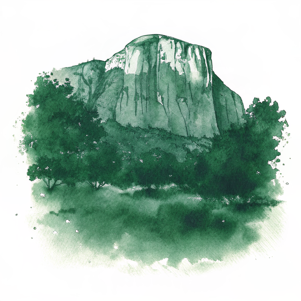
To help you build your own global archive, we've prepared this collection of watercolor studies from our research into Guadalupe Mountains, Texas. These artifacts are designed to bring the stillness of this corner of the world into your home.

Original Series Decorative Magnet

A personal study of Guadalupe Mountains, Texas, captured in high-fidelity watercolor and prepared for your collection.

Guadalupe Mountains, Texas | Guadalupe Peak Desert Bloom | Original Series Decorative Magnet
Add to Collection / $18
Exclusive Series Artifact

Original Series Gallery Canvas

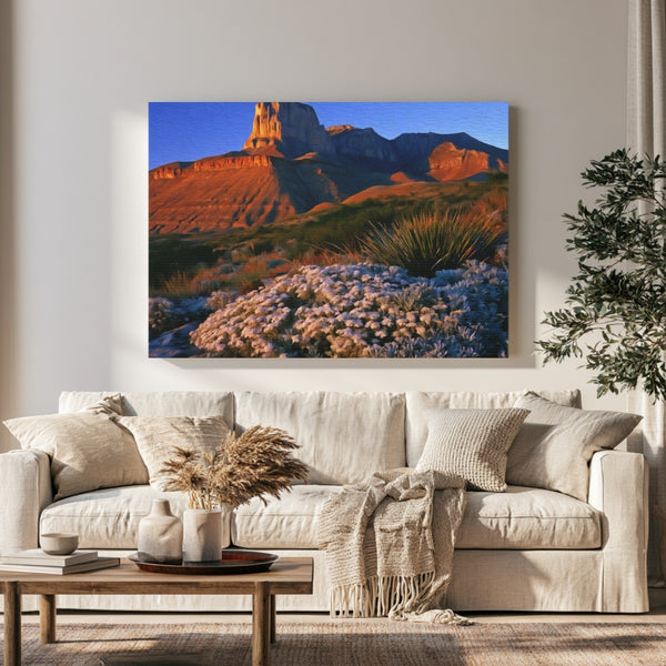
This high-fidelity canvas is a beautiful way to anchor a room and keep your memories of Guadalupe Mountains, Texas fresh long after you've returned home.

Guadalupe Mountains, Texas | Guadalupe Peak Desert Bloom | Original Series Gallery Canvas detail Guadalupe Mountains, Texas | Guadalupe Peak Desert Bloom | Original Series Gallery Canvas detail Guadalupe Mountains, Texas | Guadalupe Peak Desert Bloom | Original Series Gallery Canvas detail Guadalupe Mountains, Texas | Guadalupe Peak Desert Bloom | Original Series Gallery Canvas detail
Add to Collection / $65

Original Series Hardboard Coaster

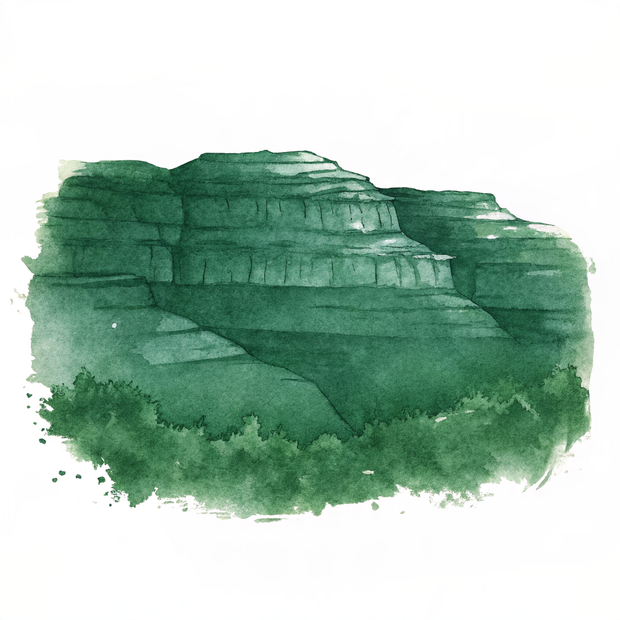
A personal study of Guadalupe Mountains, Texas, captured in high-fidelity watercolor and prepared for your collection.

Guadalupe Mountains, Texas | Guadalupe Peak Desert Bloom | Original Series Hardboard Coaster
Add to Collection / $18
Exclusive Series Artifact

The Spirit of the Land

Archival Note: A curated field study of Guadalupe Mountains, Texas, prioritizing the specific atmospheric stillness of the region. These artifacts have been meticulously sourced from our global archival partners to represent the area's unique cultural frequency and environmental character. This selection serves as a formal observation for our ongoing global archive, vetted for its visual accuracy and archival merit.

Guadalupe Mountains, Texas study No. 01
Guadalupe Mountains, Texas / 01 VIA / Daniel Erlandson
The afternoon light catches the warm sandstone cliffs in the foreground while casting deep shadows across the layered ridges beyond. Layers of blue-green mountains fade into the hazy distance, revealing the vast scale of this desert landscape. The sparse vegetation clinging to the rocky slopes and the crisp clarity of the air create a sense of wild, untamed beauty frozen in a single moment.
Guadalupe Mountains, Texas study No. 02
Guadalupe Mountains, Texas / 02 VIA / Snapwire
The crisp desert air and brilliant sunlight create a sense of vast openness and possibility along this remote Texas highway. The contrast between the weathered wooden railing in the foreground and the towering volcanic formations beyond evokes the feeling of standing at the threshold of untamed wilderness. The clear blue sky and dappled cloud cover cast dynamic shadows across the arid landscape, enhancing the dramatic beauty of this stark and serene desert setting.
Guadalupe Mountains, Texas study No. 03
Guadalupe Mountains, Texas / 03 VIA / Papillon One
This Sonoran Desert scene captures the Guadalupe Mountains in their spring bloom, when yellow wildflowers blanket the arid floor. The gnarled Joshua trees on the left draw attention with their distinctive twisted branches, creating an otherworldly silhouette against the clear sky. Most visitors focus on the dramatic jagged peaks, yet the delicate wildflowers soften the harsh desert terrain and reveal the surprising beauty hidden in this seemingly barren landscape.

Where to wander

Archival Note: A curated field study of Guadalupe Mountains, Texas, prioritizing cultural relevance and archival merit. These locations have been meticulously researched and vetted to ensure they represent the most authentic atmosphere for your own expedition.

Local Cuisine Spotlight
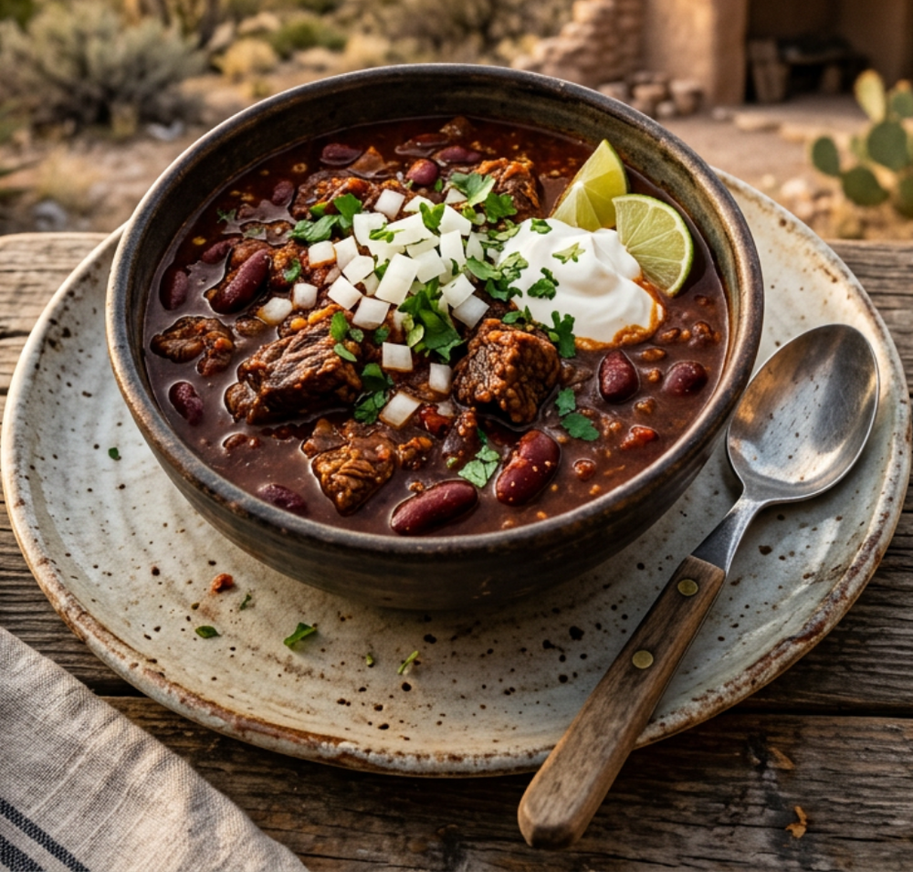
This deeply satisfying chili showcases tender braised meat and kidney beans simmered in a complex, spiced broth that carries hints of smoke and heat. Crowned with cool sour cream and fresh cilantro, each spoonful balances richness with brightness, while the lime wedge offers a final touch of tangy contrast that elevates every bite into something memorable and warming.
Credits: THE PAINTED PASSPORT
Local cuisine study in Guadalupe Mountains, Texas

☕︎ Local Flavor

Bone Daddy's Barbecue

Rating: 4* | Price: $$ | Coordinates: 31.7923, -104.9183

This beloved local smokehouse serves slow-cooked brisket, ribs, and pulled pork that have earned a loyal following among park visitors and locals alike. The portions are generous, the sides are made fresh daily, and the warm, casual atmosphere feels like eating at a friend's backyard cookout. Arrive early because the most popular cuts often sell out before the dinner rush begins.

View Entry Details

Jalisco Cafe

Rating: 5* | Price: $ | Coordinates: 31.7830, -104.9200

A true hidden gem in nearby Dell City, Jalisco Cafe serves authentic New Mexico and West Texas Mexican cuisine with recipes passed down through generations. The red and green chile enchiladas are rich, fragrant, and deeply satisfying after a full day on mountain trails. Friendly service and a colorful, welcoming dining room make every visit feel warm and personal.

View Entry Details

The Guadalupe Grille

Rating: 4* | Price: $$ | Coordinates: 31.9500, -104.8600

Perched with commanding views of the surrounding desert landscape, this casual grill is famous for its green chile cheeseburgers and freshly made pies. The menu draws on classic West Texas comfort food traditions, with locally sourced ingredients featured whenever possible. It is the kind of place where you linger over coffee and pie long after your meal is finished.

View Entry Details

Carlsbad Brewing Company

Rating: 4* | Price: $$ | Coordinates: 32.4207, -104.2288

A short drive north in Carlsbad, this lively brewpub crafts exceptional regional ales and lagers that pair beautifully with their wood-fired pizzas and smoked wings. The tap list rotates seasonally, showcasing creative desert-inspired flavors like prickly pear wheat and pinyon nut porter. The convivial atmosphere and knowledgeable staff make it a wonderful place to unwind after days in the mountains.

View Entry Details

🛌︎ Boutique Stays

The Inn of the Mountain Gods

Rating: 4* | Price: $$$ | Coordinates: 31.9023, -104.8720

Nestled near the base of the Guadalupe range, this comfortable inn offers stunning views of the rugged peaks from every room. Guests enjoy cozy bedding, a welcoming fireplace lounge, and stargazing from the outdoor patio under famously dark desert skies. It is a perfect retreat after long days exploring the trails and canyons of this remarkable region.

View Entry Details

Pine Springs Campground

Rating: 5* | Price: $ | Coordinates: 31.9241, -104.8331

Located right inside Guadalupe Mountains National Park, Pine Springs Campground places you at the heart of the wilderness experience. Wake up surrounded by pinyon pines and limestone cliffs, with the Guadalupe Peak trailhead just steps from your tent or RV site. Ranger programs and crystal-clear night skies make every evening here truly unforgettable.

View Entry Details

White's City Cavern Inn

Rating: 3* | Price: $$ | Coordinates: 32.1753, -104.7072

Just minutes from Carlsbad Caverns, this friendly inn serves as a convenient base for exploring both the caverns and the Guadalupe Mountains to the south. Rooms are clean and practical, and the staff is genuinely helpful with local trail and activity recommendations. The outdoor pool is a welcome relief after warm desert afternoons spent adventuring.

View Entry Details

Hacienda del Sol Guest Ranch

Rating: 4* | Price: $$$ | Coordinates: 31.8800, -104.9100

This charming desert guest ranch blends rustic Southwest style with genuine hospitality, offering adobe-style casitas surrounded by dramatic mountain scenery. Mornings begin with hearty homemade breakfasts, and evenings invite you to relax on a shaded porch while watching golden light wash over the Guadalupe ridgeline. The quiet, remote setting creates a deeply restorative escape from everyday life.

View Entry Details

📍︎ Field Study

Guadalupe Peak Trail

Rating: 5* | Price: Free | Coordinates: 31.9241, -104.8331

Standing at 8,751 feet, Guadalupe Peak is the highest point in all of Texas, and the trail to its summit is one of the most rewarding hikes in the entire Southwest. The 8.4-mile round trip climbs through dramatic limestone formations, offering sweeping panoramas of the Chihuahuan Desert stretching endlessly in every direction. Reaching the stainless steel monument at the top delivers an overwhelming and well-earned sense of accomplishment.

View Entry Details

El Capitan Overlook

Rating: 5* | Price: Free | Coordinates: 31.8958, -104.8544

The iconic limestone face of El Capitan is the defining image of Guadalupe Mountains National Park, rising nearly 2,000 feet above the surrounding desert floor. The overlook trail provides dramatic close-up views of this ancient reef formation, which was built by marine organisms some 265 million years ago. Photographers will find spectacular lighting conditions here at both sunrise and sunset throughout the year.

View Entry Details

McKittrick Canyon

Rating: 5* | Price: Free | Coordinates: 31.9783, -104.7561

Described by the National Park Service as the most beautiful spot in Texas, McKittrick Canyon shelters a rare riparian woodland fed by a year-round spring in the heart of the desert. In autumn, the canyon erupts in brilliant golds, oranges, and reds as bigtooth maples and ash trees change color in a spectacular seasonal display. The canyon trail winds past historic stone cabins and fossil-rich limestone walls that bring deep geological time vividly to life.

View Entry Details

Carlsbad Caverns National Park

Rating: 5* | Price: $$ | Coordinates: 32.1479, -104.5567

Just a short drive from the Guadalupe Mountains, Carlsbad Caverns is one of the most extraordinary underground landscapes on Earth, featuring the massive Big Room chamber that stretches over 8 acres beneath the desert surface. Self-guided and ranger-led tours wind past towering stalactites, delicate cave popcorn formations, and mirror-still pools reflecting centuries of geological artistry. Each evening from late spring through fall, hundreds of thousands of Brazilian free-tailed bats spiral out of the cave entrance in a breathtaking natural spectacle.

View Entry Details

Typography

Archival Note: A formal technical study of Guadalupe Mountains, Texas, archiving the coordinates, elevation, and environmental data that define the region. This data serves as a vital record for our ongoing global field study, providing the technical foundation behind every atmospheric detail captured in our visual work.

Botanical and pigment specimen study for Guadalupe Mountains, Texas Colors of Guadalupe Mountains, Texas
Coordinates
31.9241° N, 104.8331° W — Pine Springs Visitor Center, Guadalupe Mountains National Park, Culberson County, West Texas
Historical Epoch
The Mescalero Apache called these mountains home for centuries before Spanish explorers and later Anglo settlers arrived. The Butterfield Overland Mail route passed through the range in the 1850s, and the ruins of the Pinery Station still stand near Pine Springs.
Elevation
1,524-2,667 m / 5,000-8,751 ft. The park spans from desert floor to Guadalupe Peak, the highest point in Texas, with dramatic vertical relief across its trails.
Atmosphere
BWk, Cold Desert. Hot dry summers and cool winters with low humidity year-round. Afternoon thunderstorms arrive quickly in July and August and should be taken seriously on exposed ridges.
Observation Hour
06:30. The low desert sun rakes golden across the limestone faces for about forty minutes after sunrise, casting long blue shadows into the canyon draws and turning the pale rock walls a deep amber that watercolor artists chase for good reason.
Primary Pigment
Sandstone Ochre (#C8955A) and High Desert Indigo (#4A5872)
Best Time to Visit
October through November. Mild temperatures, vivid autumn color in McKittrick Canyon, and low crowds make fall the most rewarding season to visit.
Avoid Visiting
July through August. Peak heat combines with afternoon monsoon thunderstorms, creating hazardous conditions on exposed high-elevation trails.

The Local Tongue

Language is the invisible architecture of Guadalupe Mountains, Texas. These entries document the regional vocabulary—capturing the "texture" of local speech that standard translations often miss. Hand-curated expressions reflecting the specific spirit and daily rhythm of the region.
Archival study of English cultural texture

via / Amar Preciado

Primary Language English
Regional Dialect West Texas American English, with Spanish-inflected place names and ranching vocabulary common throughout the Trans-Pecos region.

Llano Estacado

Llano Estacado translates roughly as 'staked plains,' referring to the vast elevated tableland that defines the region's eastern edge. Travelers who cross it at dusk understand the name viscerally, as the flat horizon offers no shelter from the wind and the sky feels three times larger than anywhere else on earth.

Tinaja

A tinaja is a natural rock basin carved by centuries of water flow, collecting precious rainwater in an otherwise parched desert landscape. In the Guadalupes, finding a tinaja on a long trail is a quiet revelation, its cool dark water reflecting a perfect circle of sky above the canyon walls.

Pecosense

Pecosense is an informal regional term used by locals to describe the particular stubbornness and self-reliance shaped by living in the Trans-Pecos desert country for generations. It carries no direct translation but is understood immediately by anyone who has watched a rancher fix a fence line alone under a July sun without complaint.

Wait! before you go...

Before you head over to Guadalupe Mountains, Texas, we’ve audited the essential data points for this corner of the world. These notes cover the logistics—from currency ratios to transit hubs—to help you navigate the landscape with clarity.
🚲 Getting Around The vast majority of visitors arrive by private vehicle via US Highway 62/180, which runs along the southern boundary of the park. There is no public bus service, no rideshare coverage, and no fuel available within the park, so arriving with a full tank and a reliable spare tire is genuinely important.
⚖️ Cash or Card Cards are accepted at the visitor center and at the park entrance fee station, but most surrounding small businesses in towns like Dell City and Van Horn strongly prefer cash. Travelers heading into the backcountry or stopping at roadside spots should carry enough cash for meals, fuel, and any unexpected stops.
☁️ Good to Know The park observes Leave No Trace principles with unusual strictness, and rangers will engage visitors about pack-out requirements for waste on backcountry trails without hesitation. Cell service is essentially nonexistent throughout the park, which locals treat as a feature rather than a flaw, so downloading offline maps before arrival is a practical necessity.
🏧 ATMs The nearest reliable ATMs are in Van Horn, Texas, approximately 65 kilometers southeast of the park entrance on US-62/180, or in Carlsbad, New Mexico, roughly 55 kilometers to the northeast. White's City, just outside Carlsbad Caverns, has limited services but does not reliably maintain an ATM, so stocking up on cash before arriving is wise.
💳 Currency The United States Dollar (USD) is the sole currency in use throughout the region, with no currency exchange services available anywhere near the park. Travelers coming from across the border in nearby New Mexico will find identical currency and pricing with no adjustment needed.
🔌 Plugs Standard US Type A and Type B outlets operating at 120V and 60Hz. No adapter is needed for devices brought from within North America.
🛡️ Safety Afternoon lightning strikes are a genuine hazard on Guadalupe Peak and other exposed ridgelines between June and September, and descending before midday on summit days is standard local advice. Water is not available on most trails, and the combination of high elevation, dry air, and intense sun means dehydration can set in faster than it feels like it should.
✈️ Airports El Paso International Airport (ELP) is the most practical gateway, sitting approximately 175 kilometers west of the park with major carrier service and full rental car availability. Midland International Air and Space Port (MAF) lies roughly 290 kilometers to the east and serves as an alternative for travelers coming from central Texas.

Behind The Scenes

Nathan

Note from the Founder

Hey, did you know this fun fact about Guadalupe Mountains, Texas? Guadalupe Peak at 2,667 meters is the highest point in Texas. The mountain's summit holds a stainless steel pyramid monument installed in 1958 by American Airlines to commemorate the Butterfield Overland Mail route centennial.
Thank you for exploring the Guadalupe Mountains, Texas series with us. We hope these notes have inspired you to add this incredible destination to your own passport—we are so glad you're here. Nathan's signature

Some of our Favorites