Acatenango, Guatemala


Brought to you by The Painted Passport 575 destinations painted
14.5573° N, 90.7332° W
Antigua Mustard
Volcanic Ash
Welcome to our collection for Acatenango, Guatemala. Below you'll find a look at the quiet moments and textures that stayed with us long after we left. This page is a small collection of the things that made the trip special—from the spots we loved to stay and eat, to the landmarks and local typography we captured while we were wandering. Further down, you can explore our local snapshots and the original art inspired by the colors of Acatenango, Guatemala.
Museum-quality canvas 5 sizes Made to order, ships in 3–5 days
Acatenango, Guatemala | Acatenango Volcano Erupting Campsite | Original Series Gallery Canvas
Acatenango, Guatemala | Acatenango Cloud Forest Trail | Original Series Gallery Canvas
Acatenango, Guatemala | Acatenango Volcano Eruption Plume | Original Series Gallery Canvas
Acatenango, Guatemala | Acatenango Summit Above Clouds | Original Series Gallery Canvas
Acatenango, Guatemala | Acatenango Volcanic Slope Ascent | Original Series Gallery Canvas
Acatenango, Guatemala | Acatenango Volcano Glowing Tent Camp | Original Series Gallery Canvas
The Painted Passport
Acatenango, Guatemala

Shop the Collection


To help you bring a piece of your journey home, we've put together this collection of watercolor studies from our time in Acatenango, Guatemala. These are our favorite ways to keep the spirit of the trip alive.

Acatenango, Guatemala | Acatenango Volcano Erupting Campsite | Original Series Gallery Canvas close-up detail Acatenango, Guatemala | Acatenango Volcano Erupting Campsite | Original Series Gallery Canvas detail Acatenango, Guatemala | Acatenango Volcano Erupting Campsite | Original Series Gallery Canvas detail Acatenango, Guatemala | Acatenango Volcano Erupting Campsite | Original Series Gallery Canvas detail
01 Acatenango, Guatemala

Acatenango Volcano Erupting Campsite

(0) No reviews yet

Rivers of molten lava carve blazing channels down Acatenango's dark flanks while glowing tents huddle beneath a sky split between dusk and eruption. This watercolor study of Acatenango captures the volcanic plume in deep crimson and smoke, balanced against a serene indigo horizon and warm amber candlelight below.

Add to Cart $65
Launch offer · 15% off — code WELCOME15
Dimensions
Free U.S. shipping Ready to hang Ships in 3–5 days

Arrives perfect — guaranteed, or we'll make it right

Arrives ready to hang — a perfect gift.

Watercolour · The Painted Passport
Acatenango, Guatemala | Acatenango Cloud Forest Trail | Original Series Gallery Canvas close-up detail Acatenango, Guatemala | Acatenango Cloud Forest Trail | Original Series Gallery Canvas detail Acatenango, Guatemala | Acatenango Cloud Forest Trail | Original Series Gallery Canvas detail Acatenango, Guatemala | Acatenango Cloud Forest Trail | Original Series Gallery Canvas detail
02 Acatenango, Guatemala

Acatenango Cloud Forest Trail

(0) No reviews yet

Moss-draped giants lean over a steep jungle path as mist and golden light dissolve into the canopy above Acatenango. This watercolor study of the cloud forest trail captures the electric greens and ghostly blues of Guatemala's most enchanting volcano approach.

Add to Cart $65
Launch offer · 15% off — code WELCOME15
Dimensions
Free U.S. shipping Ready to hang Ships in 3–5 days

Arrives perfect — guaranteed, or we'll make it right

Arrives ready to hang — a perfect gift.

Watercolour · The Painted Passport
Acatenango, Guatemala | Acatenango Volcano Eruption Plume | Original Series Gallery Canvas close-up detail Acatenango, Guatemala | Acatenango Volcano Eruption Plume | Original Series Gallery Canvas detail Acatenango, Guatemala | Acatenango Volcano Eruption Plume | Original Series Gallery Canvas detail Acatenango, Guatemala | Acatenango Volcano Eruption Plume | Original Series Gallery Canvas detail
03 Acatenango, Guatemala

Acatenango Volcano Eruption Plume

(0) No reviews yet

A towering column of ash and steam erupts skyward from the cone of Fuego, visible from the ridge of Acatenango against a deep cobalt sky. This watercolor study of the Acatenango eruption plume captures the drama in smoky grays, warm tawny ash tones, and brilliant electric blue.

Add to Cart $65
Launch offer · 15% off — code WELCOME15
Dimensions
Free U.S. shipping Ready to hang Ships in 3–5 days

Arrives perfect — guaranteed, or we'll make it right

Arrives ready to hang — a perfect gift.

Watercolour · The Painted Passport
Acatenango, Guatemala | Acatenango Summit Above Clouds | Original Series Gallery Canvas close-up detail Acatenango, Guatemala | Acatenango Summit Above Clouds | Original Series Gallery Canvas detail Acatenango, Guatemala | Acatenango Summit Above Clouds | Original Series Gallery Canvas detail Acatenango, Guatemala | Acatenango Summit Above Clouds | Original Series Gallery Canvas detail
04 Acatenango, Guatemala

Acatenango Summit Above Clouds

(0) No reviews yet

Above a sea of cloud, the dark cone of Acatenango rises in perfect silence while a neighboring volcano breathes smoke into a burning dawn. This watercolor study of the Acatenango summit captures the electric gradient of amber and violet that ignites the Guatemalan sky at first light.

Add to Cart $65
Launch offer · 15% off — code WELCOME15
Dimensions
Free U.S. shipping Ready to hang Ships in 3–5 days

Arrives perfect — guaranteed, or we'll make it right

Arrives ready to hang — a perfect gift.

Watercolour · The Painted Passport
Acatenango, Guatemala | Acatenango Volcanic Slope Ascent | Original Series Gallery Canvas close-up detail Acatenango, Guatemala | Acatenango Volcanic Slope Ascent | Original Series Gallery Canvas detail Acatenango, Guatemala | Acatenango Volcanic Slope Ascent | Original Series Gallery Canvas detail Acatenango, Guatemala | Acatenango Volcanic Slope Ascent | Original Series Gallery Canvas detail
05 Acatenango, Guatemala

Acatenango Volcanic Slope Ascent

(0) No reviews yet

A lone climber in crimson ascends the vast grey scree of Acatenango, dwarfed beneath a sky of impossible blue. This watercolor study of the Acatenango volcanic slope captures the stark drama of ash-grey stone against deep cobalt, hushed and monumental.

Add to Cart $65
Launch offer · 15% off — code WELCOME15
Dimensions
Free U.S. shipping Ready to hang Ships in 3–5 days

Arrives perfect — guaranteed, or we'll make it right

Arrives ready to hang — a perfect gift.

Watercolour · The Painted Passport
Acatenango, Guatemala | Acatenango Volcano Glowing Tent Camp | Original Series Gallery Canvas close-up detail Acatenango, Guatemala | Acatenango Volcano Glowing Tent Camp | Original Series Gallery Canvas detail Acatenango, Guatemala | Acatenango Volcano Glowing Tent Camp | Original Series Gallery Canvas detail Acatenango, Guatemala | Acatenango Volcano Glowing Tent Camp | Original Series Gallery Canvas detail
06 Acatenango, Guatemala

Acatenango Volcano Glowing Tent Camp

(0) No reviews yet

A lone orange tent burns like a lantern against the dark ridgeline of Acatenango, while a perfect volcanic cone rises through swirling clouds above Guatemala. This watercolor study of Acatenango renders that electric contrast of warm amber and deep twilight blue in hushed, luminous strokes.

Add to Cart $65
Launch offer · 15% off — code WELCOME15
Dimensions
Free U.S. shipping Ready to hang Ships in 3–5 days

Arrives perfect — guaranteed, or we'll make it right

Arrives ready to hang — a perfect gift.

Watercolour · The Painted Passport
Field Notes

ACATENANGO, GUATEMALA | "Where the Sky Meets Fire"

Acatenango is the most spectacular overnight hiking destination in Central America, a 3,976-meter dormant stratovolcano on the Pacific volcanic arc of Guatemala, standing directly adjacent to Volcán de Fuego whose active eruptions of ash, fire, and lava can be watched from the summit camp in one of the most extraordinary natural spectacles available anywhere on earth. The ascent passes through cloud forest, pine forest, and the volcanic scrub of the upper cone, emerging above the cloud layer to a view that on clear mornings extends across the entire Pacific slope of Guatemala, the colonial city of Antigua visible in the valley below and the cone of Fuego glowing red in the darkness.

The palette shifts dramatically from the ascent to the summit: the lush tropical green of the lower forest, the grey volcanic ash of the upper cone, the brilliant white of the cloud layer below the summit camp, and the deep orange of the Fuego eruption column against the black sky at 3 AM when the coldest and most dramatic hours of the overnight unfold.

CINEMATOGRAPHY /

The Spirit of the Land

Archival Note: Documented personally during our time in Acatenango, Guatemala. While we leverage a global network of contributors to provide these high-fidelity visual artifacts, each selection is curated to reflect the specific, quiet frequencies we experienced on the ground. These textures serve as a formal study of the unhurried light and environmental character that defined our journey.

Acatenango, Guatemala study No. 01
Acatenango, Guatemala / 01 VIA / Paweł Wielądek
Lava fountaining into a dark blue sky. Glowing orange stone sprays from the peak, falling in bright lines against the quiet of the night. A single star sits above the heat, marking the contrast between the fire below and the deep stillness of the air.
Acatenango, Guatemala study No. 02
Acatenango, Guatemala / 02 VIA / Rodrigo Escalante
Santa Catalina Arch stands as a central point, its yellow form anchoring the cobblestone path. Faded red and soft blue walls line the street, creating a colorful walk through history. Terracotta roofs mark the sky. It is a moment of quiet connection in the heart of Antigua, where time seems to slow down among the colonial beauty.
Acatenango, Guatemala study No. 03
Acatenango, Guatemala / 03 VIA / Saulo Zayas
A stone cross stands watch over the valley, marking a high point above the city. Below, the red-tiled roofs of Antigua spread out in a perfect grid, leading the eye toward the massive green slopes of Volcán de Agua. It is a quiet moment where the hand-built town meets the scale of the earth and sky.

Where to wander

Archival Note: A curated field study of Acatenango, Guatemala, prioritizing cultural relevance and archival merit. These locations have been meticulously researched and vetted to ensure they represent the most authentic atmosphere for your own expedition.

Local Cuisine Spotlight
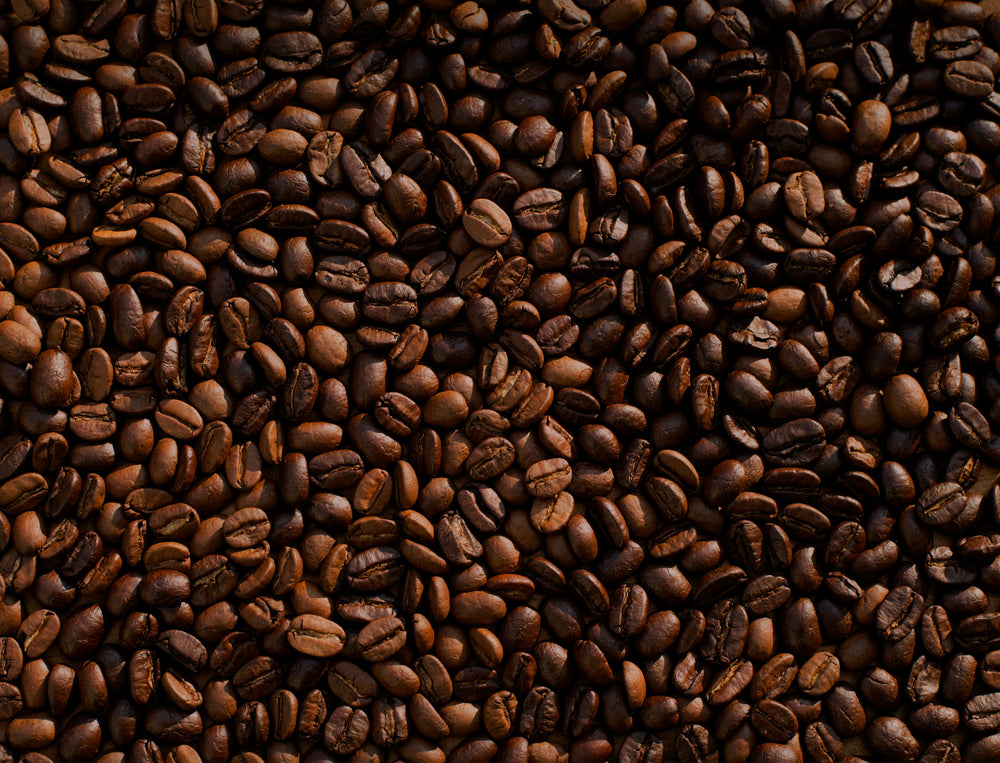
Grown in the verticality of the Sierra Madre, these beans are a product of volcanic soil and extreme altitude. The profile is defined by a dense, complex structure and a lingering, bright acidity that mirrors the sharp morning light of the Guatemalan highlands. A rustic architecture of earth, smoke, and high-elevation friction.
Credits: MIKE KENNEALLY
Local cuisine study in Acatenango, Guatemala

☕︎ Local Flavor

Authentic Guatemalan Cooking Class with Chef David Farfan

Rating: 5.0★ | Price: $$$ | Coordinates: 14.5586° N, 90.7295° W

Unearth the foundational alchemy of Guatemalan Gastronomy by hand-grinding local spices under the tutelage of a master chef. This session focuses on the preparation of Pepián, a complex stew of roasted seeds and chilies that represents the convergence of Mayan and Spanish culinary traditions. It serves as a sensory archive, preserving the ancestral techniques that have sustained the Altiplano lineage for centuries.

View Entry Details

Street Food Walking Tour with Gastronomic Tastings

Rating: 4.8★ | Price: $$ | Coordinates: 14.5612° N, 90.7344° W

Navigate the aromatic corridors of the municipal market to sample the "Three Sisters"—corn, beans, and squash—in their most elevated street forms. You will encounter the precise textures of handmade tortillas and the subtle sweetness of rellenitos made from plantains and black beans. This journey is a physical manuscript of the city's daily life, documenting the survival of indigenous flavors within a colonial grid.

View Entry Details

Guatemalan Cooking Class & Market Tour with Milton

Rating: 5.0★ | Price: $$$ | Coordinates: 14.5547° N, 90.7331° W

Ascend to a private rooftop to cook against a backdrop of volcanic peaks after selecting raw botanical ingredients from the bustling La Merced market. The experience centers on the tactile sensation of patting dough and the rhythmic chopping of fresh herbs used in traditional Kak'ik. It acts as an anchor for the city's identity, bridging the gap between the chaotic vitality of the market and the quietude of a domestic hearth.

View Entry Details

Chocolate workshop; gastronomic experience of cocoa.

Rating: 5.0★ | Price: $$ | Coordinates: 14.5594° N, 90.7342° W

Navigate the ancient lineage of the "food of the gods" by hand-roasting and winnowing raw cacao beans over an open flame. The process utilizes a traditional basalt metate to grind the nibs into a rich, obsidian paste, a technique that requires both physical rhythm and a deep sensory connection to the material. This workshop is a vital piece of the city's puzzle, preserving the pre-Hispanic tradition of cacao as a sacred currency and documenting the survival of Mayan botanical wisdom in the modern era.

View Entry Details

🛌︎ Boutique Stays

El Convento Boutique Hotel

Rating: 4.8★ | Price: $$$$ | Coordinates: 14.5598° N, 90.7299° W

Discover a sanctuary of vaulted ceilings and exposed stone located directly across from the iconic ruins of the Capuchinas Convent. The architecture utilizes local materials like volcanic stone and heavy timber to create a space that feels unearthed rather than built. It serves as a physical manuscript of Antiguan aesthetics, documenting the transition from monastic austerity to boutique refinement.

View Entry Details

Las Cruces Boutique Hotel

Rating: 4.9★ | Price: $$$$ | Coordinates: 14.5558° N, 90.7302° W

Step into a meticulously restored townhouse that captures the quiet elegance of the Spanish silver age through its silver-leafed mirrors and hand-carved cedar. Each suite overlooks a central courtyard where the sound of trickling water provides a Zen-like counterpoint to the city’s stone-paved streets. This hotel is a vital piece of the city's puzzle, offering a masterclass in the preservation of aristocratic colonial interior design.

View Entry Details

Hotel Museo Spa Casa Santo Domingo

Rating: 4.7★ | Price: $$$$ | Coordinates: 14.5604° N, 90.7282° W

Inhabit the hallowed halls of a 16th-century monastery where contemporary luxury is integrated into the basalt and brick of colonial ruins. The property houses extensive archaeological collections, including pre-Columbian ceramics and colonial religious art displayed amidst crumbling cloisters. It stands as a living museum, preserving the architectural ambition of the Dominican order within a functional, modern sanctuary.

View Entry Details

Villa Bokeh (Relais & Châteaux)

Rating: 4.9★ | Price:| Coordinates: 14.5489° N, 90.7214° W

Navigate the manicured gardens of this expansive estate, which offers a sophisticated architectural study in the fusion of modern glass and traditional stucco. The property provides an unobstructed view of Agua Volcano, framing the natural landscape as a primary element of its design language. It functions as an anchor for the city's modern identity, proving that historical reverence and avant-garde luxury can exist in a singular lineage.

View Entry Details

📍︎ Field Study

Antigua Classic Cultural Walking City Tour

Rating: 4.7★ | Price: $$ | Coordinates: 14.5591° N, 90.7335° W

Scan the intricate facades of the Baroque churches, such as La Merced, to decode the religious and political symbolism etched into the plaster. Led by seasoned historians, this tour examines the seismic history that dictated the city’s low-rise, earthquake-resistant architectural evolution. It is an essential archival exercise, documenting the resilience of a city that refused to be abandoned after the 1773 Santa Marta earthquakes.

View Entry Details

Acatenango Volcano Overnight Hiking Adventure

Rating: 4.8★ | Price: $$$ | Coordinates: 14.5006° N, 90.8757° W

Ascend the steep, ashen slopes of Acatenango to witness the raw, geological power of the neighboring Fuego Volcano’s eruptions. The trek transitions through diverse microclimates, from high-altitude cornfields to misty cloud forests and finally to a sub-alpine volcanic ridge. This excursion is a vital piece of the cultural puzzle, providing the geographic context—the "Ring of Fire"—that has shaped the destiny of the Guatemalan highlands.

View Entry Details

Mysteries of Convents and Monasteries Study

Rating: 5.0★ | Price: $$$ | Coordinates: 14.5562° N, 90.7311° W

Unearth the subterranean secrets of Antigua’s monastic life by exploring the cryptic drainage systems and hidden meditation cells of ruined cloisters. This tour focuses on the architectural ambition of the 18th-century "Clarisas" and "Capuchinas," noting the specific use of Roman arches and Spanish tile. It serves as a physical manuscript of the ecclesiastical power that once governed the Captaincy General of Guatemala.

View Entry Details

Villages of Lake Atitlán Day Study from Antigua

Rating: 4.8★ | Price: $$$ | Coordinates: 14.6907° N, 91.2017° W

Journey beyond the valley to the shores of Lake Atitlán to observe the living lineage of Mayan textile arts in the villages of San Juan and Santiago. The study prioritizes the observation of natural dyeing processes and the complex geometry of backstrap weaving, which serves as a visual language for each community. This excursion is an anchor for understanding the broader cultural ecosystem that sustains Antigua’s identity as a regional hub.

View Entry Details

Typography

Archival Note: A formal technical study of Acatenango, Guatemala, archiving the coordinates, elevation, and environmental data that define the region. This data serves as a vital record for our ongoing global field study, providing the technical foundation behind every atmospheric detail captured in our visual work.

Botanical and pigment specimen study for Acatenango, Guatemala Colors of Acatenango, Guatemala
Coordinates
14.5573° N, 90.7332° W — Guatemalan highlands, Acatenango volcanic chain
Historical Epoch
Maya settlement of the region before 300 CE. Spanish colonial capital founded in 1543 CE. Capital destroyed by earthquake in 1773 and relocated to Guatemala City. UNESCO World Heritage inscription in 1979.
Elevation
1,533 m / 5,030 ft, base camp elevation; summit at 3,976 m / 13,045 ft
Atmosphere
Subtropical Highland (Cfb). Dry season November through April with bright blue skies and cold nights, rainy season May through October, pleasantly cool year-round at 1,530 m.
Observation Hour
16:30. The Santa Catalina Arch frames the cone of Agua Volcano in the golden hour light, the yellow paintwork turning warm amber as the shadow of the mountains reaches the valley.
Primary Pigment
Antigua Mustard (#E1AD01) and Volcanic Ash (#555555)
Best Time to Visit
November through April, dry season keeps the summit clear for the classic Fuego eruption views and nights cold but bearable at altitude
Avoid Visiting
May through October, rainy season clouds the crater rim and makes the overnight approach genuinely miserable with wet ash underfoot

The Local Tongue


Language is the invisible architecture of Acatenango, Guatemala. These entries document the regional vocabulary—capturing the "texture" of local speech that standard translations often miss. Hand-curated expressions reflecting the specific spirit and daily rhythm of the region.
Archival study of Spanish cultural texture

via / Jeison Higuita

Primary Language Spanish
Regional Dialect Kaqchikel

Empedrado

The term literally translates to "stone-paved," referring to the historic, uneven cobblestones that form the city's iconic grid. In Antigua, it represents a tactile connection to the past, forcing a slower pace of life where the rhythmic rattle of traffic serves as the city’s constant heartbeat.

Penumbra

This describes a space of filtered light or the soft, partial shadow cast between extreme brightness and total dark. It captures the moody transition found within Antigua's cool, ruined archways and lush courtyards, offering a quiet refuge from the intensity of the tropical Guatemalan sun.

Arraigado

Meaning "deeply rooted" or "ingrained," this word defines a beauty or tradition that has become immovable over centuries. It reflects the resilient spirit of Antigua’s culture and flora, where ancient customs and vibrant bougainvillea remain firmly anchored to the volcanic stone despite the passage of time.

Wait! before you go...

Before you head over to Acatenango, Guatemala, we wanted to share a few basic tips we picked up along the way. These notes cover the simple things—like how to get around or what to do about cash—so you can spend less time worrying and more time just enjoying the place.
🚲 Getting Around Shared shuttles from Antigua to La Soledad basecamp take 45 minutes. Most tour operators include transport. 4WD taxis handle the final dirt road section. No public buses reach the trailhead directly.
⚖️ Cash or Card 80% Cash, 20% Card. Guatemalan Quetzales are essential for basecamp fees, porters, and local guides. Antigua ATMs are your last reliable stop. Card payments are not accepted at the volcano.
☁️ Good to Know Book an experienced guide who knows the current volcanic activity level since Fuego's eruption intensity changes weekly. Check INSIVUMEH volcanic monitoring reports before ascending. The overnight cold at 3,900 meters is more extreme than most visitors anticipate.
🏧 ATMs Stick to the Todo a la Mano (5B) or Banco Industrial bank machines located inside well-lit buildings; they are the most reliable for international cards and offer the highest level of physical security in the valley.
💳 Currency The Guatemalan Quetzal (GTQ) is the sole currency. Withdraw sufficient cash in Antigua before departure since no financial services exist at the basecamp or on the mountain. Tour operator fees can be paid by card in Antigua.
🔌 Plugs Guatemala uses Type A and Type B plugs, the standard North American flat-pin sockets, at 120V. No power is available at the basecamp or overnight shelters on the mountain. A fully charged power bank is essential.
🛡️ Safety The real danger is the uneven, 500-year-old cobblestones; twisted ankles are common, so prioritize footwear over fashion. Additionally, avoid walking alone on the outskirts of town after dark or on isolated trails like Cerro de la Cruz without a group.
✈️ Airports La Aurora International Airport (GUA) in Guatemala City handles all international arrivals. The airport is 45 minutes to 1.5 hours from Antigua depending on traffic. Direct flights from the USA, Mexico, and several European hubs.

Behind The Scenes

Nathan

Note from the Founder

Hey, did you know this fun fact about Acatenango, Guatemala? In Antigua, the street signs aren't just names, they are pictures! Long ago, because many people couldn't read, the city used symbols like a lion or a crown so everyone knew exactly which street they were on.
Thank you for exploring the Acatenango, Guatemala series with us. We hope these notes have inspired you to add this incredible destination to your own passport—we are so glad you're here. Nathan's signature

Some of our Favorites